Tag: Brockton

Statewide Fatal Crashes In MA, November 2021

Statewide Fatal Crashes In MA, November 2021

Each month in 2021, we plan to post about the fatal crashes in Massachusetts from the previous month, and share any trends that we see. For the full list of monthly posts, head here.

Last month, we took a look at the seven fatal crashes listed in the MassDOT Crash Portal in October. In this post, we’ll look at crashes in MA in November 2021. The information in the chart below is compiled from news reports, and was checked against the MassDOT Crash Portal Dashboard “Fatal Information by Year.” The Google Street View images included below use the address listed in the crash portal.

  • Of the 36 fatal crashes in Massachusetts in November in the MassDOT Crash portal, eight were identified as people walking. We have also included one additional fatal pedestrian crash that was covered in the Cape Cod Times which may not have been submitted yet to MassDOT (as of 12/16).
  • The crash portal does not include names. The name of three of the people walking who died have not been made public yet.
  • The average age of pedestrians hit & killed in November was 68.3.
  • At least two of the crashes were hit & runs (as referenced in news articles).
  • The name of the person driving was only identified in two of the crashes in news articles that we found.

Date11/3/2021, 12:28 PM
Location632 State St.
TownSpringfield
TypePEDESTRIAN
Age40
SexM

40-year-old Michael Diaz Vargas was struck and killed on State Street in Springfield. WWLP reported that the 26-year-old driver, Eric Reyes of Springfield, faces charges of motor vehicle homicide by negligence and unlicensed operation of a motor vehicle.

According to the MassDOT Road Inventory, this street is under local jurisdiction. It is two-way, with 2 travel lanes in each direction, separated by a grassy median. There is a sidewalk on each side. There is no crosswalk across State Street. The speed limit is listed as 35mph.


Date11/5/2021, 11:30 AM
LocationWashington St. + Downing Rd.
TownBrookline
TypePEDESTRIAN
Age63
SexF

Brookline Patch reported that 63-year-old Patricia “Patty” Arellano was in a crosswalk when she was struck and killed by the driver of a vehicle. The unidentified driver was cited for failure to stop for a pedestrian in a crosswalk. She had been traveling on Washington Street and turned right onto Downing Road where she struck Patty.

According to the MassDOT Road Inventory, both streets are under local jurisdiction. Washington Street is two-way, with 1 travel lane in each direction. There is a sidewalk on each side. There is a crosswalk across Downing Road where Patty was struck. The speed limit is 30mph.

In January 2020, WalkBoston met with Boston City Councilor Liz Breadon and representatives of Boston’s Office of Neighborhood Services and Age Strong Commission at the B’nai B’rith Housing’s Covenant House & Patricia White Apartments (a 3 minute walk on Washington Street from the location in Brookline where Patty was killed). Residents shared that drivers speed along Washington Street mainly during non-rush hour times of day as they come down the hill on Washington away from Commonwealth Avenue, which leads to dangerous conditions for pedestrians trying to use the crosswalks. The City of Boston has since implemented changes to those crosswalks as part of the Allston Brighton Mobility Plan.


Date11/9/2021, 7:15 AM
LocationI-495 NORTH + SR-138
TownRaynham
TypePEDESTRIAN
Age57
SexM

MassLive reported that 57-year-old Christopher Sheppard was hit and killed in a multiple vehicle crash on I-495. From the MassLive story:

Lauren Dyer, 62, of Braintree, who was driving a pickup truck, was pronounced dead at the scene after being crushed between two vehicles. Another driver, Christopher Sheppard, who was hit while on foot outside his vehicle, died Tuesday night in a Rhode Island Hospital, authorities say. He was transported to the hospital after the incident with severe injuries.

According to the MassDOT Road Inventory, this street is under MassDOT jurisdiction. It is a limited access highway, with 3 travel lanes in each direction, separated by a grassy median. The speed limit is listed as 65mph.
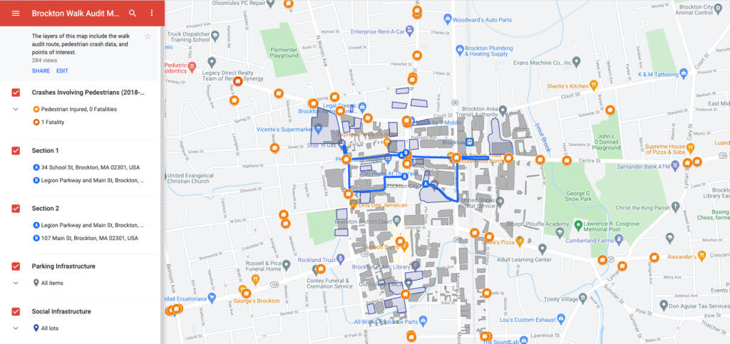

Date11/9/2021, 5:11 PM
Location1367 Main St.
TownBrockton
TypePEDESTRIAN
Age73
SexF

The Boston Globe reported an unidentified 73-year-old woman was fatally struck and killed by a driver in Brockton on Main Street. The article included a statement from the Plymouth District Attorney’s office: “Brockton Police contacted Massachusetts State Police assigned to the Plymouth County District Attorney’s Office and an investigation commenced. The investigation is ongoing at this time.”

According to the MassDOT Road Inventory, this street is under local jurisdiction. (Main Street is Route 28, and some sections of Route 28 in Brockton are under MassDOT control.) Main Street is two-way, with 1 travel lane in each direction. There is a sidewalk on each side. There is a crosswalk without curb ramps across Main Street at this address. The speed limit is 35mph.


Date11/10/2021, 6:14 PM
Location235 State St.
TownSpringfield
TypePEDESTRIAN
Age56
SexF

StreetsblogMASS reported a driver struck and killed Gayle Ball, a Springfield City library employee, age 56, while she was crossing State Street. It was the third death caused by a motor vehicle driver on State Street so far this year and second pedestrian that was hit/killed in November.

MassLive reported that the city is now making a change to State Street:

In a press briefing in city hall, public works director Christopher Cignoli said the redesign is thought of as the best way to address the safety concerns on State Street caused by the conflicting issues of pedestrians not using a crosswalk and vehicles driving fast or recklessly.

As part of the redesign, the city intends to install a crosswalk, elevated 4 to 8 inches above the roadway, between the Central Library and St. Michael’s Cathedral.

According to the MassDOT Road Inventory, this street is under local jurisdiction. It is two-way, with 2 travel lanes in each direction, separated by a grassy median. There is a sidewalk on each side. There is no crosswalk across State Street. The speed limit is listed as 35mph in the Road Inventory. (It is posted as 25mph in one direction and 30mph in the other direction on Google Streetview, which dates to September 2019).


Date11/22/2021, approx 5:47 PM
LocationRoute 28 near junction of Orchard Road and Asher’s Path
TownMashpee
TypePEDESTRIAN
Age91
SexF

This crash was not listed in the crash portal as of 12/16; this info is from Cape Cod Times reporting.

The Cape Cod Times reported 91-year-old Dorothy Henderson was struck by two vehicles several minutes after she exited a Cape Cod Regional Transit Authority bus at the junction of Orchard Road and Asher’s Path on Route 28 in Mashpee on Nov. 22, according to Mashpee police. Although Henderson was initially conscious after the accident, she died from her injuries on the way to the hospital. The two drivers were not identified.

Her friend, Frances Delgado, described the intersection near the crash location:

With no crosswalk, or pedestrian stop signal at the Route 28 intersection, Delgado said cars must have had a hard time spotting [Dorothy]. “The green light is so short. You can barely make a turn there, let alone somebody walking across there. It’s so dark. You can’t see anybody out there,” Delgado said. “After this is all said and done, we need a crosswalk or safety precautions put in place. We are a 55 and older living community and it’s not right that our lives are at risk in this way.”

According to the MassDOT Road Inventory, this road is under MassDOT jurisdiction. It is two-way, with 1 travel lane in each direction. There is a painted median, which is replaced by a turning lane on approach to the intersection. There are no sidewalks on this portion of Route 28. There are no crosswalks at the intersection. The speed limit is 50mph.


Date11/23/2021, 6:44 PM
LocationLynnway + Newhall St.
TownLynn
TypePEDESTRIAN
Age76
SexM

NBC Boston reported that an unidentified 76-year-old Lynn resident was struck and killed in a crosswalk on the Lynnway by the driver of a 2007 Jeep Commander, a 32-year-old Lynn resident.

According to the MassDOT Road Inventory, this street is under MassDCR jurisdiction. It is two-way, divided parkway, with 2 travel lanes and parking in one direction and 3 travel lanes in the other direction. There is a sidewalk on each side. There is a crosswalk and signal at Newhall Street. The speed limit is 35mph.


Date11/30/2021, 7:47 AM
Location172 Winslow Gray Rd. NORTH
TownYarmouth
TypePEDESTRIAN
Age85
SexM

85-year-old Alexander Gribko was struck and killed on a side access road along Winslow Gray Road in Yarmouth. The driver fled the scene. Alexander was found by a police officer on routine patrol in the morning, though police believe he may have been struck a little after 5pm the day before while returning home from an afternoon walk. Police are still trying to identify the driver and the vehicle that struck Gribko, according to a Cape Cod Times article from mid-December.

WCVB spoke to Alexander’s neighbors:

“He’s friendly. He’d talk with all the people up and down the street, because he was out walking,” said resident Phil Johnston.

Residents are in shock that anyone could hit Gribko and leave him to die in the dark and the cold.

“It’s absurd. I just don’t get it. How could anybody do that?” asked resident Tom Vuono.

The address is listed as 172 Winslow Gray Rd in the crash portal; NBC Boston’s coverage shows tire tracks and police evidence markings along the side access road. According to the MassDOT Road Inventory, this street is under local jurisdiction. It is two-way, with 1 travel lane in each direction. There are no sidewalks, but there is a side access road. The speed limit is 30mph.


Date11/30/2021, 12:54 PM
LocationNorth Main St. + Wright St.
TownPalmer
TypePEDESTRIAN
Age74
SexM

WWLP reported 74-year-old Joseph Labroad of Palmer died after being struck by a vehicle allegedly driven by 33-year-old Nicole Mantanes of Palmer. The driver left the scene but was located soon after. She faces seven counts including: OUI Liquor 2nd offense, negligent operation of a MV, marked lanes violation, leaving the scene of an accident resulting in serious injury/ death, motor vehicle homicide, speeding, and inspection sticker violation.

According to the MassDOT Road Inventory, this street is under local jurisdiction. This stretch of North Main Street is two-way, with 1 travel lane in each direction. There is a sidewalk on each side of the road up to Wright Street, and on one side after it. There are no crosswalks at the intersection. The speed limit is 30mph.


Updates

If you have an update about a community member who was killed in one of these crashes, please contact Brendan so we can update our . WalkBoston has maintained a list each year since 2016, pulling the information from news reports, social media, and from people like you that share the information with us.

Yearly trackers:  |||||


Reminder about the data from the MassDOT portal

MassDOT makes no representation as to the accuracy, adequacy, reliability, availability or completeness of the crash records or the data collected from them and is not responsible for any errors or omissions in such records or data. Under no circumstance will MassDOT have any liability for any loss or damage incurred by any party as a result of the use of the crash records or the data collected from them. Furthermore, the data contained in the web-based crash report tool are not an official record of what transpired in a particular crash or for a particular crash type. If a user is interested in an official copy of a crash report, contact the Registry (http://www.mass.gov/rmv/). The City of Boston Police Department may be contacted directly for official copies of crash reports and for crash data pertaining to the City of Boston. In addition, any crash records or data provided for the years after 2018 are subject to change at any time and are not to be considered up-to-date or complete. As such, open years’ of crash data are for informational purposes only and should not be used for analysis. The data posted on this website, including crash records and other reports, are collected for the purpose of identifying, evaluating or planning the safety enhancement of potential crash sites, hazardous roadway conditions or railway-highway crossings. Under federal law, this information is not subject to discovery and cannot be admitted into evidence in any federal or state court proceeding or considered for other purposes in any action for damages that involves the sites mentioned in these records (see 23 USC, Section 409).

Statewide Fatal Crashes In MA, October 2021

Statewide Fatal Crashes In MA, October 2021

Each month in 2021, we plan to post about the fatal crashes in Massachusetts from the previous month, and share any trends that we see. For the full list of monthly posts, head here.

Last month, we took a look at the five fatal crashes listed in the MassDOT Crash Portal in September. In this post, we’ll look at crashes in MA in October 2021. The information in the chart below is compiled from news reports, and was checked against the MassDOT Crash Portal Dashboard “Fatal Information by Year.” The Google Street View images included below use the address listed in the crash portal.

  • Of the 28 fatal crashes in Massachusetts in October in the MassDOT Crash portal, seven were identified as people walking.
  • The crash portal does not include names. The name of two of the people walking who died have not been made public yet.
  • The average age of pedestrians hit & killed in October was 65.
  • At least one of the crashes were hit & runs (as referenced in news articles).
  • The name of the person driving was only identified in one of the crashes in news articles that we found.
  • We could not find any news reports for one of the fatal crashes.

Date10/4/2021, 9:45 AM
Location66 Huttleston Ave.
TownFairhaven
TypePEDESTRIAN
Age77
SexF

We could not find any news coverage of this crash. If you have any information, please let us know.

According to the MassDOT Road Inventory, this street is under MassDOT jurisdiction. This stretch of Huttleston Avenue (State Route 6) is two-way, with 2 travel lanes in each direction. There is a sidewalk on each side of the road. The speed limit is unclear in the MassDOT Road Inventory, with 25mph and 35mph both listed.


Date10/13/2021, 1:30 PM
LocationEssex St. + Winter St.
TownLawrence
TypePEDESTRIAN
Age73
SexF

The Eagle-Tribune reports that a driver struck and killed 73-year-old Antoquia M. Ruiz Villlona De Anziani in the area of Essex Street & Winter Street in Lawrence. The driver was not identified.

According to the MassDOT Road Inventory, both of these streets are under local jurisdiction. Each road is two-way, with 1 travel lanes in each direction. It is a 2-way stop, with stop signs for the Winter/Medford Street approach (Winter Street becomes Medford St as it crosses Essex). There is a sidewalk on each side of each road. There is no painted crosswalk over Essex Street. The speed limit is unclear in the MassDOT Road Inventory, and not obvious on Google Street View.


Date10/14/2021, 6:44 PM
LocationNorth Main St. + Huntington St.
TownBrockton
TypePEDESTRIAN
Age54
SexM

The Enterprise News reports that Joao Fernandes, age 54, died after the driver of a Mel’s ice cream truck struck him at the intersection of North Main Street and Huntington Street. The driver was not identified.

According to the MassDOT Road Inventory, North Main Street and Huntington Street are both under local jurisdiction. Each road is two-way, with 1 travel lane in each direction. There is a stop sign on Huntington Street as it meets North Main Street. There is a sidewalk on each side of each road. There is a crosswalk across Huntington Street, but no painted crosswalk over North Main Street. The speed limit is 30mph in the MassDOT Road Inventory.


Date10/16/2021, 10:26 AM
LocationTheodore Glynn Way
TownBoston
TypePEDESTRIAN
Age59
SexF

Lisa Vadeboncoeur was killed and two other people were injured after 46-year-old Kevin McCaffrey struck them on Theodore Glynn Way in Boston. WHDH reported that he has been charged with motor vehicle homicide by operating under the influence of drugs, negligent operation of a motor vehicle, and two counts of assault and battery with a dangerous weapon. Their coverage included a statement from Suffolk District Attorney Rachael Rollins:

“Ms. Vadeboncoeur and the two other individuals injured in this crash were standing well off the side of the road when they were struck,” Suffolk District Attorney Rachael Rollins said in a statement. “My office has been in contact with each of the victims and the loved ones of Ms. Vadeboncoeur. We will continue to be available to provide them and the two surviving victims with the support and resources they may need and that they deserve.”

According to the MassDOT Road Inventory, Theodore Glynn Way is under local jurisdiction. It is a one-way road that is 64-feet wide; there is parking on the left side. Street View from November 2020 does not show any lane markings. There is a sidewalk on one side of the road and a shoulder on the other side. The speed limit is not noted in the MassDOT Road Inventory.


Date10/21/2021, 1:55 PM
Location704 North Quincy St.
TownBrockton
TypePEDESTRIAN
Age79
SexM

A 79-year-old man was struck and killed by a driver on North Quincy Street in Brockton. Neither the driver nor the pedestrian were identified.

The Enterprise News observed that this was the second fatal crash in a week in Brockton.

According to the MassDOT Road Inventory, North Quincy Street is under local jurisdiction. The road is two-way, with 1 travel lane in each direction. There is a sidewalk on each side of the road, but there is a large curb cut on one side shared by the Brookfield Plaza and a used car dealer. (The Enterprise News story includes photos of police investigators examining this side of the road/driveways.) The speed limit is 30mph in the MassDOT Road Inventory.


Date10/26/2021, 6:23 AM
LocationWalk Hill St.
TownBoston (Mattapan)
TypePEDESTRIAN
Age47
SexF

A bus driver hit and killed Jennifer Formichelli and then left the scene at the corner of Walk Hill Street and Blue Hill Avenue. CBS Boston reported that Formichelli was walking her two dogs at the time. Neighbors said one stayed by her side, and the other ran home, alerting neighbors. The Boston Globe reported that bus and driver was not affiliated with Boston Public School system, but the police have located the driver and school bus, and homicide detectives are investigating. The driver was not identified.

CBS Boston also interviewed Fillmore Parris, who was engaged to Jennifer:

He said Formichelli was an English teacher, loved her pets and her family. “She was just an all-around good person.”

“I’m sad but I’m just getting increasingly angry,” Parris said. “I don’t care if you’re driving a tank, you know if you’ve hit somebody, especially somebody that is as visible as her, running with two dogs.”

According to the MassDOT Road Inventory, Walk Hill Street is under local jurisdiction. It is a two-way road that is 40-feet wide; there is parking and sidewalks on each side, and there is a crosswalk across Walk Hill Street. The speed limit is 30mph in the MassDOT Road Inventory. There is a traffic signal at the intersection of Blue Hill Avenue and Walk Hill Street.


Date10/27/2021, 7:38 PM
Location528 Southwest Cutoff
TownWorcester
TypePEDESTRIAN
Age66
SexM

66-year old Fabio D’Assis was hit and killed by the driver of a Toyota Highlander SUV. The Worcester Telegram & Gazette cited a police spokesperson that “the initial investigation indicates the driver approached the Auburn/Worcester line and saw the pedestrian, but was unable to stop in time.” The driver was not identified, but is described as a 42-year-old Sudbury woman.

The T&G story locates the crash near 557 Southwest Cutoff, while the MassDOT Crash Portal lists 528 Southwest Cutoff. 557 Southwest Cutoff is closest to the Auburn/Worcester line referenced in the article, so the Google Streetview included below reflects that section of road. There is a grocery store plaza on one side, with housing on the other side of the road.

According to the MassDOT Road Inventory, Southwest Cutoff is under MassDOT jurisdiction. It is a two-way road that is 48-feet wide, with 2-lanes in each direction; there are sidewalks on each side. The speed limit is 35mph in the MassDOT Road Inventory.


Updates

If you have an update about a community member who was killed in one of these crashes, please contact Brendan so we can update our . WalkBoston has maintained a list each year since 2016, pulling the information from news reports, social media, and from people like you that share the information with us.

Yearly trackers:  |||||


Reminder about the data from the MassDOT portal

MassDOT makes no representation as to the accuracy, adequacy, reliability, availability or completeness of the crash records or the data collected from them and is not responsible for any errors or omissions in such records or data. Under no circumstance will MassDOT have any liability for any loss or damage incurred by any party as a result of the use of the crash records or the data collected from them. Furthermore, the data contained in the web-based crash report tool are not an official record of what transpired in a particular crash or for a particular crash type. If a user is interested in an official copy of a crash report, contact the Registry (http://www.mass.gov/rmv/). The City of Boston Police Department may be contacted directly for official copies of crash reports and for crash data pertaining to the City of Boston. In addition, any crash records or data provided for the years after 2018 are subject to change at any time and are not to be considered up-to-date or complete. As such, open years’ of crash data are for informational purposes only and should not be used for analysis. The data posted on this website, including crash records and other reports, are collected for the purpose of identifying, evaluating or planning the safety enhancement of potential crash sites, hazardous roadway conditions or railway-highway crossings. Under federal law, this information is not subject to discovery and cannot be admitted into evidence in any federal or state court proceeding or considered for other purposes in any action for damages that involves the sites mentioned in these records (see 23 USC, Section 409).

Statewide Fatal Crashes In MA, April 2021

Statewide Fatal Crashes In MA, April 2021

Each month in 2021, we plan to post about the fatal crashes in Massachusetts from the previous month, and share any trends that we see. Last month, we took a look at the 7 fatal crashes listed in the MassDOT Crash Portal in March. In this post, we’ll look at crashes in MA in April 2021. The information in the chart below is compiled from news reports, and was checked against the MassDOT Crash Portal Dashboard “Fatal Information by Year.” The Google Street View images included below use the address listed in the crash portal.

  • Of the 38 fatal crashes in Massachusetts in April in the MassDOT Crash portal, 6 were identified as people walking.
  • The crash portal does not include names. The names of 4 of the people walking who died have not been made public yet.
  • The average age of pedestrians hit & killed in April was 45. (One person’s age is listed as “unknown.”)
  • At least 4 of the crashes were hit & runs (as referenced in news articles).
  • The name of the person driving was not identified in any of the crashes in news articles that we found.

Update 11/15/2022:

On April 26th, Denise Stracqualursi, an employee of Roche Bros – Acton, was killed in the parking lot when she was bringing groceries out to an awaiting customer. Read the story in MassLive: Denise Stracqualursi, 56-year-old woman struck by car in Acton grocery store parking lot, has died, authorities said – masslive.com


Date4/12/2021, 8:40 PM
LocationMcGrath Highway + Blakeley Ave.
TownSomerville
TypePEDESTRIAN
Age72
SexM

72-year-old Marshall Mac was hit on McGrath Highway at Blakeley Avenue at 8:40PM while on his way home from the grocery store by a driver who fled the scene in East Somerville. Marshall died on April 29th from his injuries. The driver, age 64, later turned himself in and faces charges of leaving the scene of a crash that caused personal injury. According to the MassDOT Road Inventory, McGrath Highway is under MassDOT jurisdiction. There is no crosswalk at Blakeley Avenue (you can see a person standing on the island. It is a desire line to connect Foss Park and the neighborhoods to the north to the closest grocery store, Stop and Shop. It also would allow residents to avoid walking near the dangerous Rt 28/38 interchange with 93. 200 people rallied on May 26th to pressure MassDOT to accelerate fixes to the surrounding area, including sound barriers and pedestrian safety improvements that have been long called for through multiple Road Safety Audits.

The Somerville Alliance for Safe Streets encourages you to sign a petition to MassDOT, as three of their neighbors have died on McGrath Highway and Mystic Avenue in the last two years, and attend an upcoming virtual public hearing on June 8th at 6pm to press for changes as part of a recently announced I-93 rehab project (Zoom link).


Date4/13/2021, 4:30 AM
LocationI-93 SOUTH, EXIT 6
TownBraintree
TypePEDESTRIAN
Age42
SexM

Thomas Gill, age 42, was hit and killed on Route 93 in Braintree; NBC Boston reported that the driver or drivers that struck him did not stop. According to the MassDOT Road Inventory, I-93 is under MassDOT jurisdiction.


Date4/13/2021, 11:18 AM
LocationCabot St. + Merrimack St.
TownLowell
TypePEDESTRIAN
Age63
SexM

A 63-year-old man was hit and killed by a driver on Merrimack Street at Cabot Street in Lowell. The Lowell Sun reported that the person was flown to a Boston-area trauma center with serious injuries. According to the MassDOT Road Inventory, this intersection is under local jurisdiction. The speed limit is 30 mph.


Date4/15/2021, 9:08 PM
LocationI-190 NORTH, MM 10.6
TownSterling
TypePEDESTRIAN
Age29
SexM

A 29-year old man crossed the median into a northbound lane while driving, exited his car to inspect a flat tire in the breakdown lane, and was hit and killed by two drivers on I-190 in Sterling. WWLP reported that the first driver fled the scene, while the second person, a 37-year old, stopped after the crash; State Police were still seeking the driver that left the scene.


Date4/22/2021, 11:09 PM
Location453 Centre St.
TownBrockton
TypePEDESTRIAN
Age
SexUNK

The Enterprise reported that a 39-year-old Charlestown woman was hit and seriously injured by a driver in an SUV on Centre Street in Brockton. The 44-year-old driver stayed at the scene. According to the MassDOT Road Inventory, Centre Street (Rt 123) is under MassDOT jurisdiction. It is one lane in each direction, with a 35 mph speed limit. There is a plaza on one side of the street and a school on the other.


Date4/24/2021, 2:53 AM
LocationSR-140 NORTH, EXIT 7 – Braley Rd. ramp
TownNew Bedford
TypePEDESTRIAN
Age19
SexM

In New Bedford, South Coast Today reported that a 19 year old person was ejected from a vehicle in a crash on the ramp for Rt 140; the person was then hit by another driver who fled the scene. FARS determined that this is categorized as a pedestrian crash since the person was outside of a vehicle when struck.


Updates

If you have an update about a community member who was killed in one of these crashes, please contact Brendan so we can update our . WalkBoston has maintained a list each year since 2016, pulling the information from news reports, social media, and from people like you that share the information with us.

Yearly trackers:  |||||


Reminder about the data from the MassDOT portal

DISCLAIMER:  The compilation of data is based on preliminary data we receive from a variety of local sources.  Some of the data may differ slightly from information provided by NHTSA as this dashboard does not use imputation methods.  Information is subject to change when/if updated information becomes available. Data updated daily as reported by police departments.

where we’ve been lately – May 2021 update

where we’ve been lately – May 2021 update

As summer approaches, we’ve been ramping up our work all over the Commonwealth!

Here are a few places we’ve been working with people lately, either in person or virtually, to help make their community more walkable:

  1. Blandford
  2. Boston
  3. Brockton
  4. Cambridge
  5. Chelsea
  6. Concord
  7. Cummington
  8. Egremont
  9. Haverhill
  10. Huntington
  11. Medford
  12. New Bedford
  13. Quincy
  14. Springfield
  15. Worcester
Strengthening Connections to Community and Transit in Gateway Cities

Strengthening Connections to Community and Transit in Gateway Cities

Since September 2020, WalkBoston has conducted a series of walk audits in Gateway Cities across the Commonwealth as part of our “Gateway Cities: Social Infrastructure and Walkability” project in partnership with MassINC and with support from the Solomon Foundation. We’re hosting walk audits in five Gateway Cities, in the area around each city’s downtown commuter rail station, in order to advance better connections to transit-oriented development (TOD) zones and public amenities in these communities.

WalkBoston and MassINC created interactive maps for participants in each community, noting the walking route, and highlighting the sites of pedestrian-involved crashes, social/gathering spaces, and the vast amount of the study area occupied by parking infrastructure. Click here to go to the interactive Google map.

This project not only assesses the neighborhoods’ walking conditions but also looks at the availability of spaces that foster gathering and social connection, such as parks, plazas, community centers, and cafes. Through virtual discussions, as well as sharing written and visual observations, we’re working with residents, municipal staff, and other community members to identify assets and opportunities, and develop program, infrastructure, and policy recommendations based on participants’ visions for the area. In addition to effecting change at the local level, WalkBoston and MassINC will produce policy papers based on the findings from these walk audits to inform state policy and budgetary investment in Gateway Cities.

So far, we’ve completed virtual walk audits in three cities as part of this project: SpringfieldFitchburg, and Brockton. Over the past year, the desire to live in a community with comfortable walking paths, open space, and street activity has dramatically increased as people spent more time at home and in their neighborhoods. The walk audits we’ve already completed have demonstrated that there is a lot of energy and enthusiasm to create more walkable, vibrant public spaces in our partner communities. In Fitchburg, participants are forming a bike/ped committee to advance the walk audit’s findings. In Brockton, residents looking for ways to get more involved in decision-making in their community used the walk audit to connect with municipal staff and each other and learn about joining committees, boards, and task forces.

Next, we’re kicking off our Haverhill walk audit tonight, Thursday, May 27th. This will be the first walk audit in the Gateway Cities series to include an in-person group walk option – we’re excited to get back to walking together again!