Category: Statewide Efforts

Comments on Re-Imagining Massachusetts’ Post-Pandemic Transportation System

Comments on Re-Imagining Massachusetts’ Post-Pandemic Transportation System

Comments to Senate Committee on Re-Imagining Massachusetts Post-Pandemic Resiliency

Dear Senator Hinds and Committee Members:

WalkBoston is Massachusetts’ primary pedestrian advocacy organization, working across the Commonwealth to make it safer and easier for people to walk for all activities of daily living such as access to transit, school and jobs. The COVID-19 pandemic gave stark evidence that walkable neighborhoods and communities are critical to physical and mental health, to reducing isolation and to the resilience of all Massachusetts residents and their neighborhoods.

In light of the pandemic, we have learned that key components of the transportation system to support walking should include:

  • Speed management. We need measures to control, and often reduce, speeds on Commonwealth roadways so that they are safe for all roadway users. During the initial months of the pandemic, there was dangerous speeding on roadways across Massachusetts. MassDOT’s ongoing initiative to create tools and measures to set and manage safe speeds on all MassDOT roadways (other than limited access highways) needs the support and encouragement of the legislature to ensure its success, and then to bring those same measures to municipal roads as well.
  • Safe connections to transit. As we learned during the pandemic, essential workers are more dependent on transit than many others. We need fully accessible transit and bus stops throughout Massachusetts, including safe street crossings and sidewalk connections to adjacent neighborhoods. These are crucial to a transit system that works for everyone.
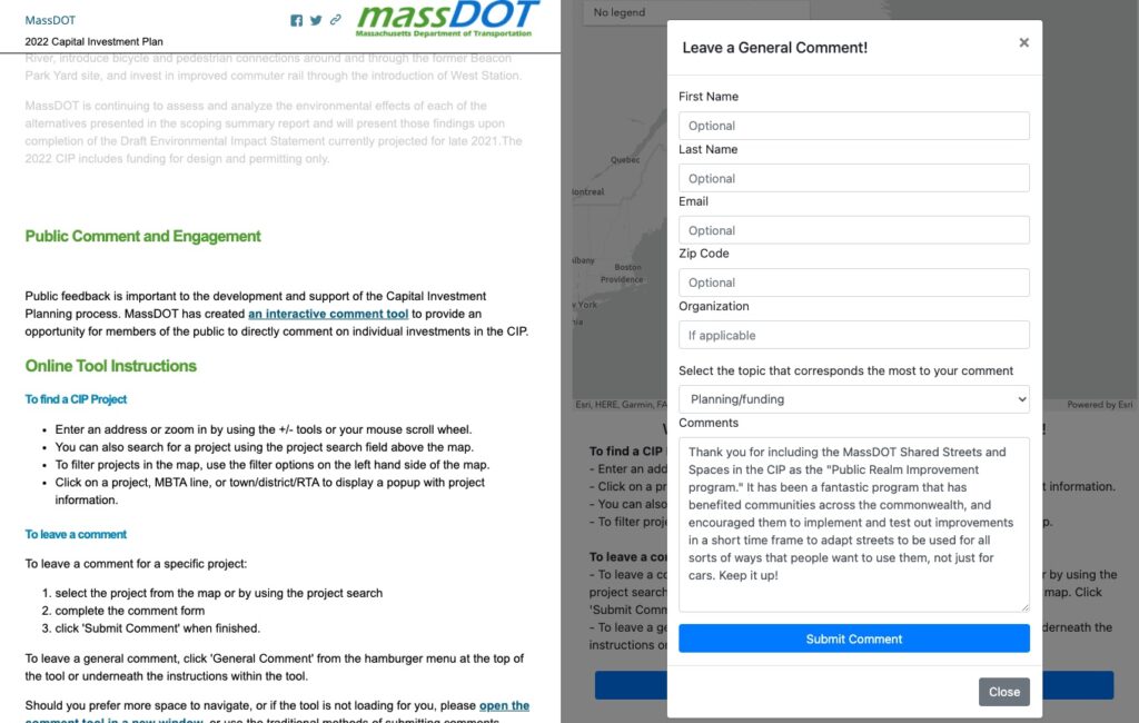
  • More local funding to repurpose public space. The overwhelmingly popular MassDOT Shared Streets and Spaces program that was introduced in response to the pandemic has demonstrated that municipalities are interested and ready to rethink how they use their streets to enable more and safer outdoor recreation,
    commerce, community activities, and mobility.
  • Chapter 90 and Complete Streets. Chapter 90 funds have been traditionally used to build and maintain municipal roads without requirements that sidewalks and crosswalks be included. We suggest that the Committee review this standard and consider including Complete Streets measures within Chapter 90, similar to those requirements set by the legislature for MassDOT roadways.
  • DCR Parkways. DCR’s recently released (and long delayed) Parkway Master Plan clearly demonstrates that immediate action is needed to vastly improve safety for people bicycling and walking. Parkways are cultural and historic landmarks and should remain fully integrated components of parks and open spaces, used and enjoyed by people for walking, rolling, and riding as originally intended. With a commitment to accelerated improvement in partnership with MassDOT, parkways should remain under DCR’s purview. We urge the legislature to set funding and regulatory standards for DCR as follows:
    • Adopt MassDOT’s Complete Streets guidelines as their default design standard for all parkways;
    • Utilize MassDOT crash portal data to implement quick-build improvements on the most dangerous parkway roads and intersections within the next 12 months;
    • Align its parkway speed limits with local speed limits, especially in municipalities where the default speed has been reduced to 25 miles/hour or less;
    • Provide DCR with the budget needed to complete the recommendations in the DCR Parkway Master Plan;
    • Require DCR to set measurable goals to reduce the number of serious and fatal crashes on DCR roadways and report publicly and annually on progress toward these goals; and
    • Require DCR to add analysis and recommendations for several key parkways currently missing from the plan.

Thank you for the opportunity to comment.

Stacey Beuttell
Executive Director, WalkBoston
405 Waltham Street, Suite 309
Lexington, MA 02421
617-367-9255

Statewide Fatal Crashes In MA, May 2021

Statewide Fatal Crashes In MA, May 2021

Each month in 2021, we plan to post about the fatal crashes in Massachusetts from the previous month, and share any trends that we see. Last month, we took a look at the 6 fatal crashes listed in the MassDOT Crash Portal in April. In this post, we’ll look at crashes in MA in May 2021. The information in the chart below is compiled from news reports, and was checked against the MassDOT Crash Portal Dashboard “Fatal Information by Year.” The Google Street View images included below use the address listed in the crash portal.

  • Of the 31 fatal crashes in Massachusetts in May in the MassDOT Crash portal, 8 were identified as people walking.
  • The crash portal does not include names. The names of 4 of the people walking who died have not been made public yet.
  • The average age of pedestrians hit & killed in May was 50.75.
  • At least 1 of the crashes were hit & runs (as referenced in news articles).
  • The name of the person driving was not identified in any of the crashes in news articles that we found.

Date5/13/2021, 1:47 PM
Location21 Collins St.
TownSalisbury
TypePEDESTRIAN
Age53
SexM

53 year old Kevin Perkins was struck and killed by a driver on Collins Street (Rt 286) in Salisbury. The Daily News of Newburyport reported that Kevin worked for a landscape company and was struck by his co-worker driving a dump truck while trying to park a trailer. According to the MassDOT Road Inventory, this street is under local jurisdiction. The speed limit is 30 mph, and there are no sidewalks.


Date5/17/2021, 10:06 AM
Location110 Broadway
TownMethuen
TypePEDESTRIAN
Age60
SexF

60 year old Aida Brito was struck and killed by a driver as she crossed Broadway (Route 28) in Methuen. Police spokesperson Lt. Randy Haggar told the Eagle Tribune that there was no crosswalk where Brito was walking and that speed did not appear to have been a factor.

According to the MassDOT Road Inventory, this street is under local jurisdiction and the speed limit is 20mph. Streetview on Google Maps shows that it is approximately 1,376 feet (over a quarter of a mile) between the crosswalks at Oakland Ave/Broadway and Center St/Broadway.


Date5/18/2021, 10:20 AM
Location2 Boland St.
TownSpringfield
TypePEDESTRIAN
Age33
SexM

An unidentified 33 year old man was hit and killed in Springfield on Boland Way. The driver fled the scene. Western Mass News reports that the person driving was found and that the person killed was a worker on a nearby construction site.

According to the MassDOT Road Inventory, this street is under local jurisdiction and the speed limit is 25mph. There are two travel lanes in each direction and sidewalks on both sides of the street.


Date5/18/2021, 10:20 PM
LocationSR-1 NORTH + Broadway
TownSaugus
TypePEDESTRIAN
Age38
SexF

An unidentified 38 year old woman was hit and killed on Rt 1 North in Saugus near the intersection of Route 99; NBC 10 Boston reports that the 45 year old driver of an SUV remained at the scene, and that the two right lanes were closed for about two hours while the scene was cleared and the investigation began.

According to the MassDOT Road Inventory, this road is a divided highway and under MassDOT jurisdiction. The speed limit is 50mph. There is a sidewalk along the side of the road.


Date5/19/2021, 6:52 AM
LocationMain St. + Bacon St.
TownWaltham
TypePEDESTRIAN
Age63
SexM

Billy Clark, a 63 year old Watertown man, was hit and killed while in a crosswalk by the driver of a tractor trailer who was turning left off Main Street onto Bacon Street in Waltham. WCVB reported that Billy was well known and liked by residents.

According to the MassDOT Road Inventory, both Main and Bacon are under local jurisdiction. Main Street has a speed limit of 35mph and Bacon has a speed limit of 30mph.


Date5/22/2021, 1:34 AM
LocationNewport Ave. + Willow Ave.
TownQuincy
TypePEDESTRIAN
Age62
SexM

62 year old Robert Jansen was hit and killed on Newport Avenue by a 21 year old driver of a Jeep. The Boston Globe reports that “an initial observation of the crash determined that there was approximately 278 feet of visible skid marks leading up to the motor vehicle and victim.”

According to the MassDOT Road Inventory, Newport Avenue is under local jurisdiction. The speed limit is 35mph. There are two travel lanes in each direction, a sidewalk on one side of the street, and a crosswalk at the intersection which leads to a pedestrian tunnel so that people can walk underneath the MBTA tracks.


Date5/22/2021, 2:35 PM
Location297 Central Turnpike
TownSutton
TypePEDESTRIAN
Age28
SexF

The Worcester Telegram & Gazette reports that 28 year old Kaylie Piekarczyk was riding her motorcycle in Sutton when she lost control, and was then hit by the driver of an oncoming SUV.

It is likely that FARS determined that this is categorized as a pedestrian crash since the person was no longer on their motorcycle when struck. [Update, 3/23/2022: this was re-categorized as a motorcycle crash.]


Date5/29/2021, 12:00 AM
LocationBradford St. Bangs St.
TownProvincetown
TypePEDESTRIAN
Age69
SexM

An unidentified 69 year old man was hit and killed at the corner of Bradford and Bangs Street in Provincetown according to CapeCod.com.

According to the MassDOT Road Inventory, both streets are under local jurisdiction, and have speed limits of 20-25mph. Bradford Street is 20 feet wide, with one lane in each direction; Bangs Street is 14 feet wide and operates as a two way yield street. While there are no sidewalks, there is a crosswalk at Bangs Street.


Updates

If you have an update about a community member who was killed in one of these crashes, please contact Brendan so we can update our . WalkBoston has maintained a list each year since 2016, pulling the information from news reports, social media, and from people like you that share the information with us.

Yearly trackers:  |||||


Reminder about the data from the MassDOT portal

DISCLAIMER:  The compilation of data is based on preliminary data we receive from a variety of local sources.  Some of the data may differ slightly from information provided by NHTSA as this dashboard does not use imputation methods.  Information is subject to change when/if updated information becomes available. Data updated daily as reported by police departments.

Springfield Walk Audit in Upper Hill neighborhood with Way Finders

Springfield Walk Audit in Upper Hill neighborhood with Way Finders

On June 11, 2021 WalkBoston joined Way Finders and 15 local community members to complete an in-person walk audit of the Upper Hill neighborhood in Springfield, MA. Special emphasis was placed on accessibility and ADA compliance, as Springfield does not currently have an ADA transition plan. Residents are concerned about making Upper Hill a safer and more welcoming neighborhood for all people, especially the elderly, children, and people with mobility issues. 

The walk audit began at Celestial Praise Church of God and residents walked east on Wilbraham Road towards the intersection at Roosevelt Ave. Participants stopped along the way to identify areas for infrastructure improvements such as safer crosswalks, addition of benches for respite, and dangerous and uneven sidewalks. Participants are interested in improving the access to Adams Park, which currently is inaccessible from the southern side of Wilbraham street as there is no crosswalk.

The next steps include a walk audit debrief on July 1, with WalkBoston and Way Finders, to collect participants’ opinions and recommendations. WalkBoston will generate a summary report of the findings for Way Finders.

WalkBoston is a technical service provider to communities through the Mass in Motion program. Mass in Motion is a statewide movement that promotes opportunities for healthy eating and active living in cities and towns across the state of Massachusetts.

Poll: 64 percent consider making streets safer for walking “very important”

Poll: 64 percent consider making streets safer for walking “very important”

Poll: Boston-area voters support changes to local streets, 64% consider making streets safer for walking “very important”

Good news! The MassINC polling group found that voters support changes to local streets, even if it means less space for cars. On top of that, 64% of people surveyed think it is VERY IMPORTANT to make streets safer for walking, while 39% of people surveyed said they will walk MORE than they did before the pandemic. Read more about it on Streetsblog MASS.

What’s this mean?

Today’s MassINC poll shows that voters love these efforts, and want to see more. The poll results reflect what we’ve been hearing as we’ve with people across Massachusetts over the last year: people want to be able to walk in their neighborhoods, but need to be able to cross the street safely. 

What can you do today to help? Comment on the CIP 

Communities big and small across the Commonwealth have re-examined how their streets can be used over the last year thanks to the MassDOT Shared Streets and Spaces program, and we’ve got good news: there is funding in the 2022 Capital Investment Plan (CIP) for it to continue.

Send in a quick note of support for the Public Realm Improvements Grant Program. That is the 2022 CIP name for MassDOT’s Shared Streets and Spaces program that was launched as a pilot this past year and has been WILDLY successful. (Check out our list of all the projects that cities and towns committed to implementing through Shared Streets and Spaces so far.) MassDOT extended the deadline for public comments on its draft FY2022 CIP to next Monday June 14th.

Here’s how to comment:

  • View a StopyMap of the CIP here, click “Public Comment” from the Table of Contents to send a message through the comment form. Click the big blue “General Comment” button to write your message.
  • Prefer to comment another way? You can email MassCIP@state.ma.us, or send a letter to: Capital Investment Plan, 10 Park Plaza, Suite 4160, Boston, MA 02116

More about the Public Realm Improvements (aka Shared Streets and Spaces)* This program will continue a successful initiative launched in FY 21 to provide grants for cities and towns to launch or expand improvements to sidewalks, curbs, streets, on-street and off street parking in support of public health, safe mobility, and commerce in their communities. $20 million has been authorized in the transportation bond bill, with $4 million in 2022 capital funding. *The authorization for Public Realm is reflected in the 2022 CIP as a new Shared Streets and Spaces program. (Source: DRAFT 2022 Capital Investment Plan, page 22)

Thanks for your support of safe walking and safe streets!

Statewide Fatal Crashes In MA, April 2021

Statewide Fatal Crashes In MA, April 2021

Each month in 2021, we plan to post about the fatal crashes in Massachusetts from the previous month, and share any trends that we see. Last month, we took a look at the 7 fatal crashes listed in the MassDOT Crash Portal in March. In this post, we’ll look at crashes in MA in April 2021. The information in the chart below is compiled from news reports, and was checked against the MassDOT Crash Portal Dashboard “Fatal Information by Year.” The Google Street View images included below use the address listed in the crash portal.

  • Of the 38 fatal crashes in Massachusetts in April in the MassDOT Crash portal, 6 were identified as people walking.
  • The crash portal does not include names. The names of 4 of the people walking who died have not been made public yet.
  • The average age of pedestrians hit & killed in April was 45. (One person’s age is listed as “unknown.”)
  • At least 4 of the crashes were hit & runs (as referenced in news articles).
  • The name of the person driving was not identified in any of the crashes in news articles that we found.

Update 11/15/2022:

On April 26th, Denise Stracqualursi, an employee of Roche Bros – Acton, was killed in the parking lot when she was bringing groceries out to an awaiting customer. Read the story in MassLive: Denise Stracqualursi, 56-year-old woman struck by car in Acton grocery store parking lot, has died, authorities said – masslive.com


Date4/12/2021, 8:40 PM
LocationMcGrath Highway + Blakeley Ave.
TownSomerville
TypePEDESTRIAN
Age72
SexM

72-year-old Marshall Mac was hit on McGrath Highway at Blakeley Avenue at 8:40PM while on his way home from the grocery store by a driver who fled the scene in East Somerville. Marshall died on April 29th from his injuries. The driver, age 64, later turned himself in and faces charges of leaving the scene of a crash that caused personal injury. According to the MassDOT Road Inventory, McGrath Highway is under MassDOT jurisdiction. There is no crosswalk at Blakeley Avenue (you can see a person standing on the island. It is a desire line to connect Foss Park and the neighborhoods to the north to the closest grocery store, Stop and Shop. It also would allow residents to avoid walking near the dangerous Rt 28/38 interchange with 93. 200 people rallied on May 26th to pressure MassDOT to accelerate fixes to the surrounding area, including sound barriers and pedestrian safety improvements that have been long called for through multiple Road Safety Audits.

The Somerville Alliance for Safe Streets encourages you to sign a petition to MassDOT, as three of their neighbors have died on McGrath Highway and Mystic Avenue in the last two years, and attend an upcoming virtual public hearing on June 8th at 6pm to press for changes as part of a recently announced I-93 rehab project (Zoom link).


Date4/13/2021, 4:30 AM
LocationI-93 SOUTH, EXIT 6
TownBraintree
TypePEDESTRIAN
Age42
SexM

Thomas Gill, age 42, was hit and killed on Route 93 in Braintree; NBC Boston reported that the driver or drivers that struck him did not stop. According to the MassDOT Road Inventory, I-93 is under MassDOT jurisdiction.


Date4/13/2021, 11:18 AM
LocationCabot St. + Merrimack St.
TownLowell
TypePEDESTRIAN
Age63
SexM

A 63-year-old man was hit and killed by a driver on Merrimack Street at Cabot Street in Lowell. The Lowell Sun reported that the person was flown to a Boston-area trauma center with serious injuries. According to the MassDOT Road Inventory, this intersection is under local jurisdiction. The speed limit is 30 mph.


Date4/15/2021, 9:08 PM
LocationI-190 NORTH, MM 10.6
TownSterling
TypePEDESTRIAN
Age29
SexM

A 29-year old man crossed the median into a northbound lane while driving, exited his car to inspect a flat tire in the breakdown lane, and was hit and killed by two drivers on I-190 in Sterling. WWLP reported that the first driver fled the scene, while the second person, a 37-year old, stopped after the crash; State Police were still seeking the driver that left the scene.


Date4/22/2021, 11:09 PM
Location453 Centre St.
TownBrockton
TypePEDESTRIAN
Age
SexUNK

The Enterprise reported that a 39-year-old Charlestown woman was hit and seriously injured by a driver in an SUV on Centre Street in Brockton. The 44-year-old driver stayed at the scene. According to the MassDOT Road Inventory, Centre Street (Rt 123) is under MassDOT jurisdiction. It is one lane in each direction, with a 35 mph speed limit. There is a plaza on one side of the street and a school on the other.


Date4/24/2021, 2:53 AM
LocationSR-140 NORTH, EXIT 7 – Braley Rd. ramp
TownNew Bedford
TypePEDESTRIAN
Age19
SexM

In New Bedford, South Coast Today reported that a 19 year old person was ejected from a vehicle in a crash on the ramp for Rt 140; the person was then hit by another driver who fled the scene. FARS determined that this is categorized as a pedestrian crash since the person was outside of a vehicle when struck.


Updates

If you have an update about a community member who was killed in one of these crashes, please contact Brendan so we can update our . WalkBoston has maintained a list each year since 2016, pulling the information from news reports, social media, and from people like you that share the information with us.

Yearly trackers:  |||||


Reminder about the data from the MassDOT portal

DISCLAIMER:  The compilation of data is based on preliminary data we receive from a variety of local sources.  Some of the data may differ slightly from information provided by NHTSA as this dashboard does not use imputation methods.  Information is subject to change when/if updated information becomes available. Data updated daily as reported by police departments.